The Forts of St Croix
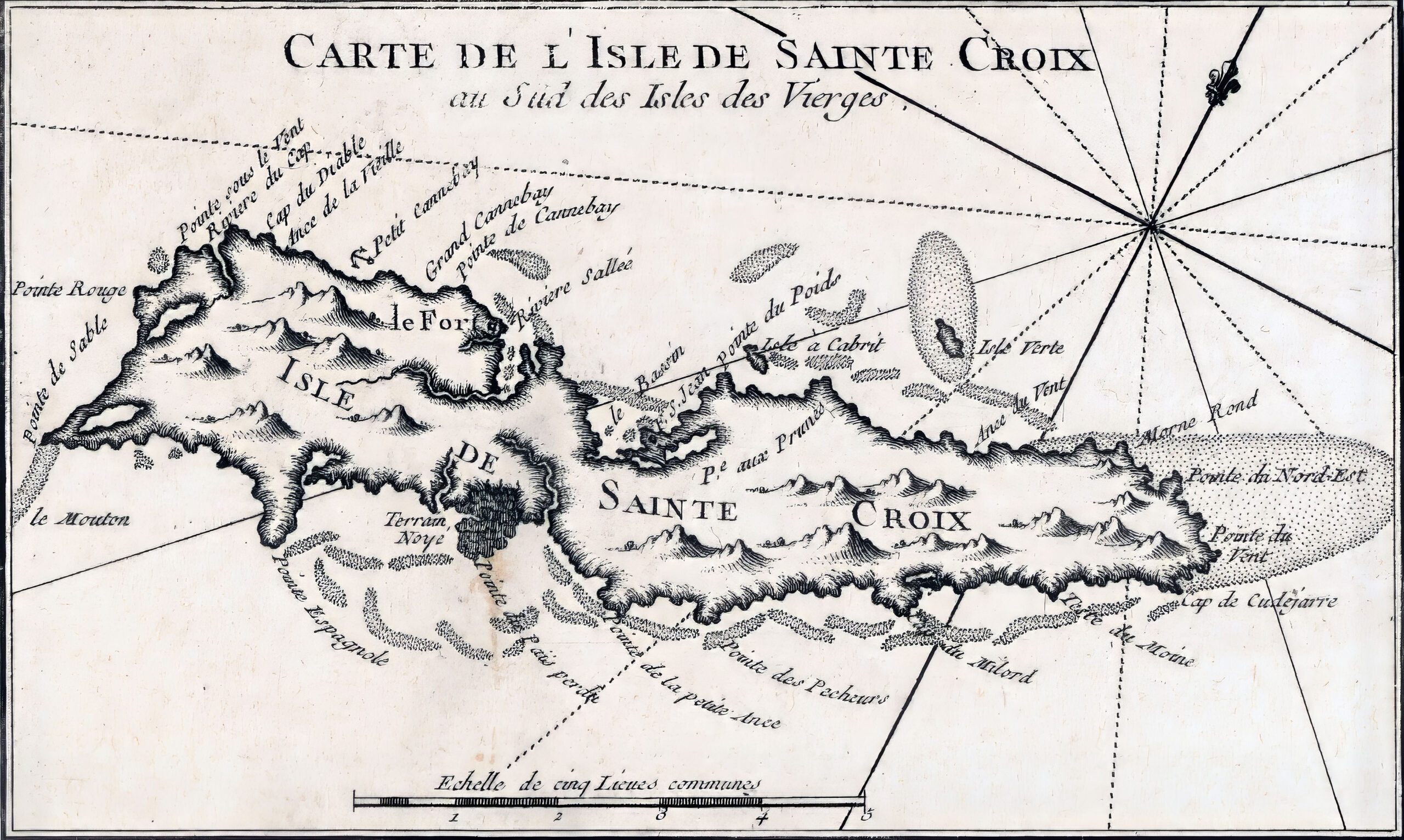
In the Library of Congress archives, is an old, undated, French map of St Croix and Puerto Rico, which is listed amongst the Maps of the Interests page.
Shown here is the St Croix portion with “le Fort” clearly marked at “Riviere Sallee”, Salt River.
This topic of St Croix forts originated from a question posed by a young woman crewing on the Denis Sullivan. She mentioned hearing about twelve forts on St. Croix – a claim I found dubious. To the best of my knowledge, there were only four forts during the Danish rule.
Information shared by Craig Harms of Sea Thru Kayaks highlighted the presence of Grieg’s Fort (1788-1801) in the Salt River Bay National Historical Park and Ecological Preserve. Also known as Fort St. Jacques, only remnants of the earthen berm remain today, although historical maps confirm its existence. Additionally, NPS records mention Fort Flamand / Fort Sale (1642-1665) from the French occupation era in the same area. Olassee Davis described Fort Flamand as an 11-cannon earth fortification in a Daily News op-ed from 06/06/2017.
To establish a common understanding, let’s define what constitutes a fort. An 18th-century Danish Caribbean fort served to safeguard colonial interests, fend off threats, curb smuggling, and uphold order. It needed to be defensible, equipped with barracks for troops, and armed with cannons. Based on these criteria, I maintain that there were only four forts on St. Croix.
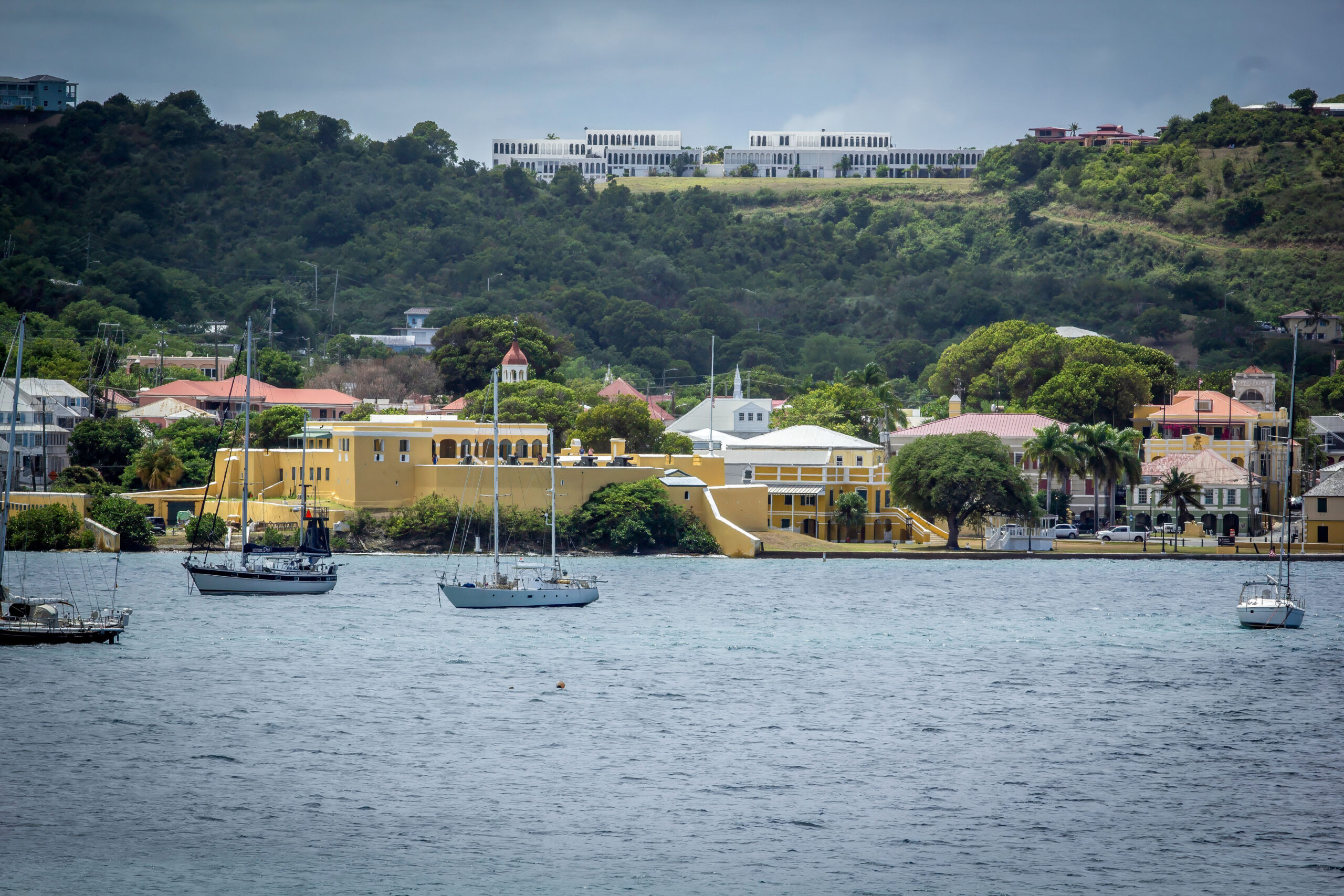
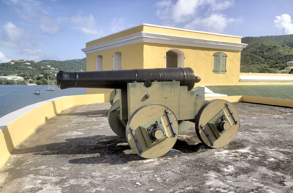
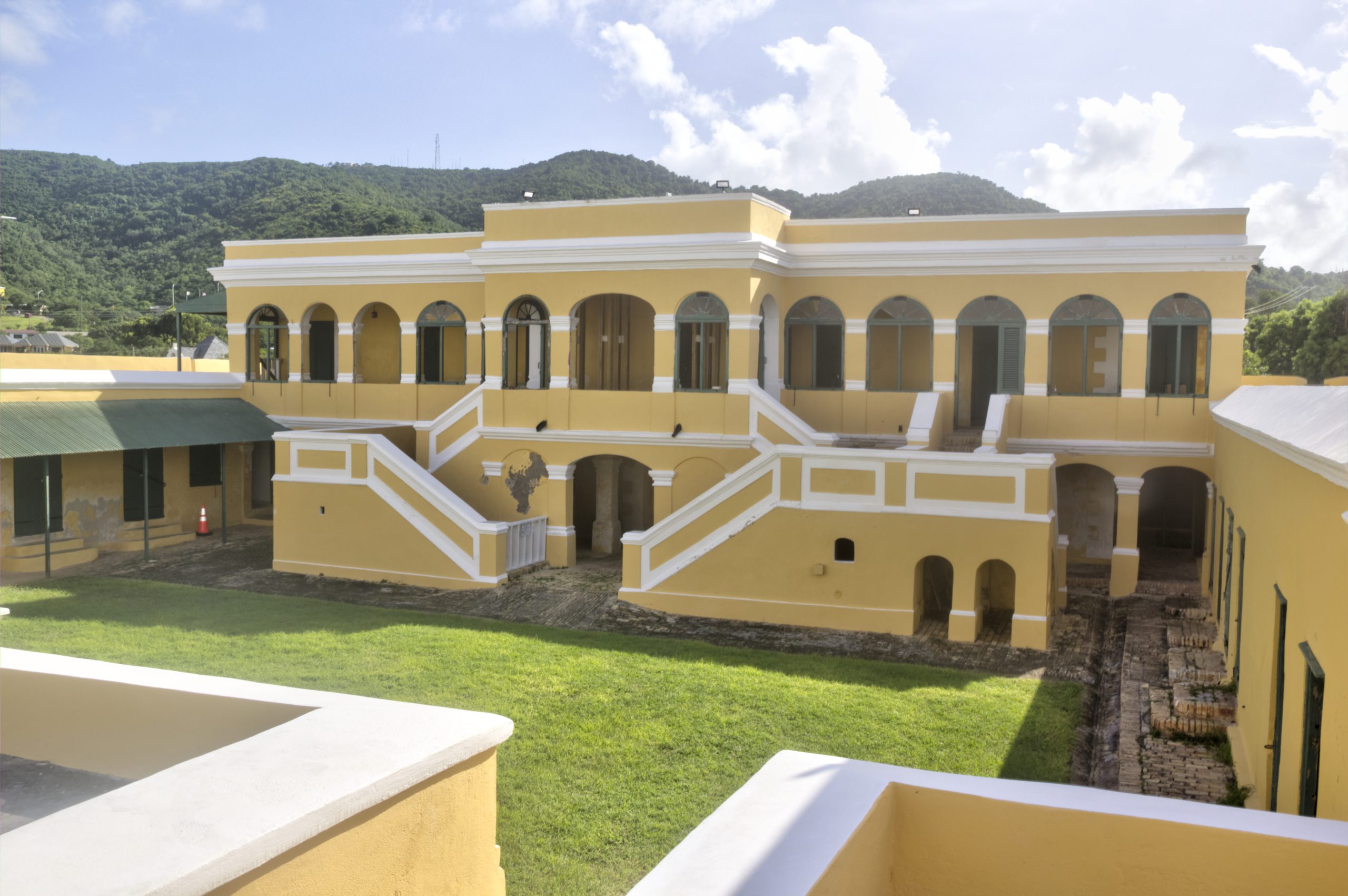
Fort Christiansvaern – Christiansted National Historic District
Fort Christiansvaern, located in Christiansted, was built by the Danes in the 18th century. Its construction was completed in 1749, and has served as a military defense structure, and a prison. Today, Fort Christiansvaern is part of the Christiansted National Historic District, managed by the National Park Service.
The NPS website gives extensive coverage of Fort Christiansvaern, and the Historic District.
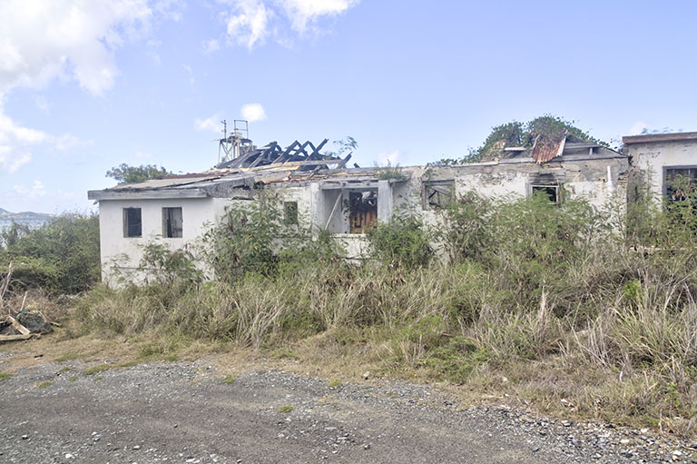
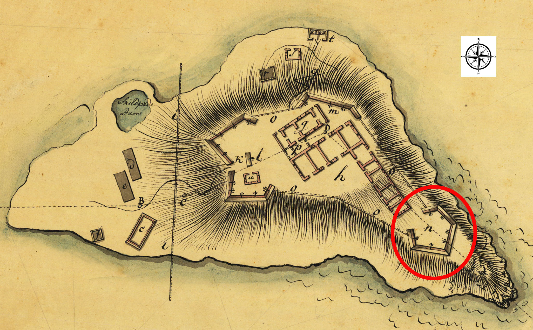
Fort Louise Augusta – Altona Lagoon
On occasions when brush has receded, you can access this battery location from Altona Lagoon Park, crossing the bridge and taking the right hand road around the park loop, then up the hill towards the old fort location. The Source had a nice article on the site.1
The barracks building was most recently used as a radio station but appears significantly degraded by a fire a few years back. The barracks and kitchen constructions extensively use Flensburg bricks, and the video shows what little remains of the western battlement which sported 2, 4# cannon facing WNW and 1, 6# cannon facing NE. The now non-existent eastern battlement housed 1, 8# and 1, 6# facing NW and 1, 6# and 1, 4# facing ENE.
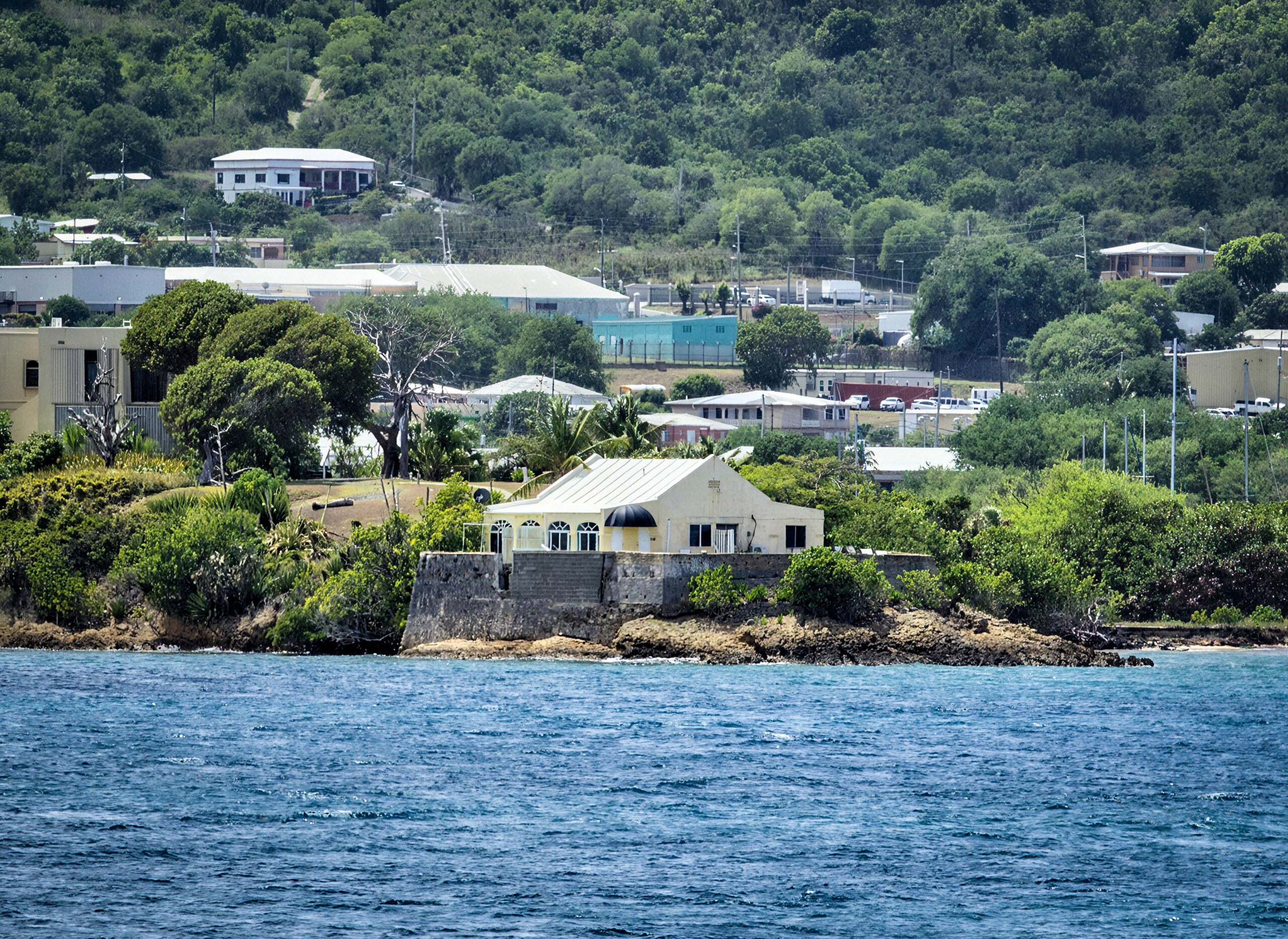
Fort Sophia Frederica – Protestant Cay
In “St Croix Under Seven Flags”, Florence Lewisohn states that in 1778, a fort named Fort Sophia Frederica was built on the cay and completed the following year.
The fort was named for Sophie Frederikke 2 who was the daughter of Duke Louis of Mecklenburg-Schwerin. She was married to Frederick, son of King Frederick V of Denmark, who was the half-brother of King Christian VII. Sophie Frederikke later became the mother of King Christian VIII.
The fort had a battery of four cannon which could be allocated amongst the six cannon positions giving crossfire protection to the entrance of Christiansted harbor. Other reports say the fort was constructed in the 1780s and completed in 1788.
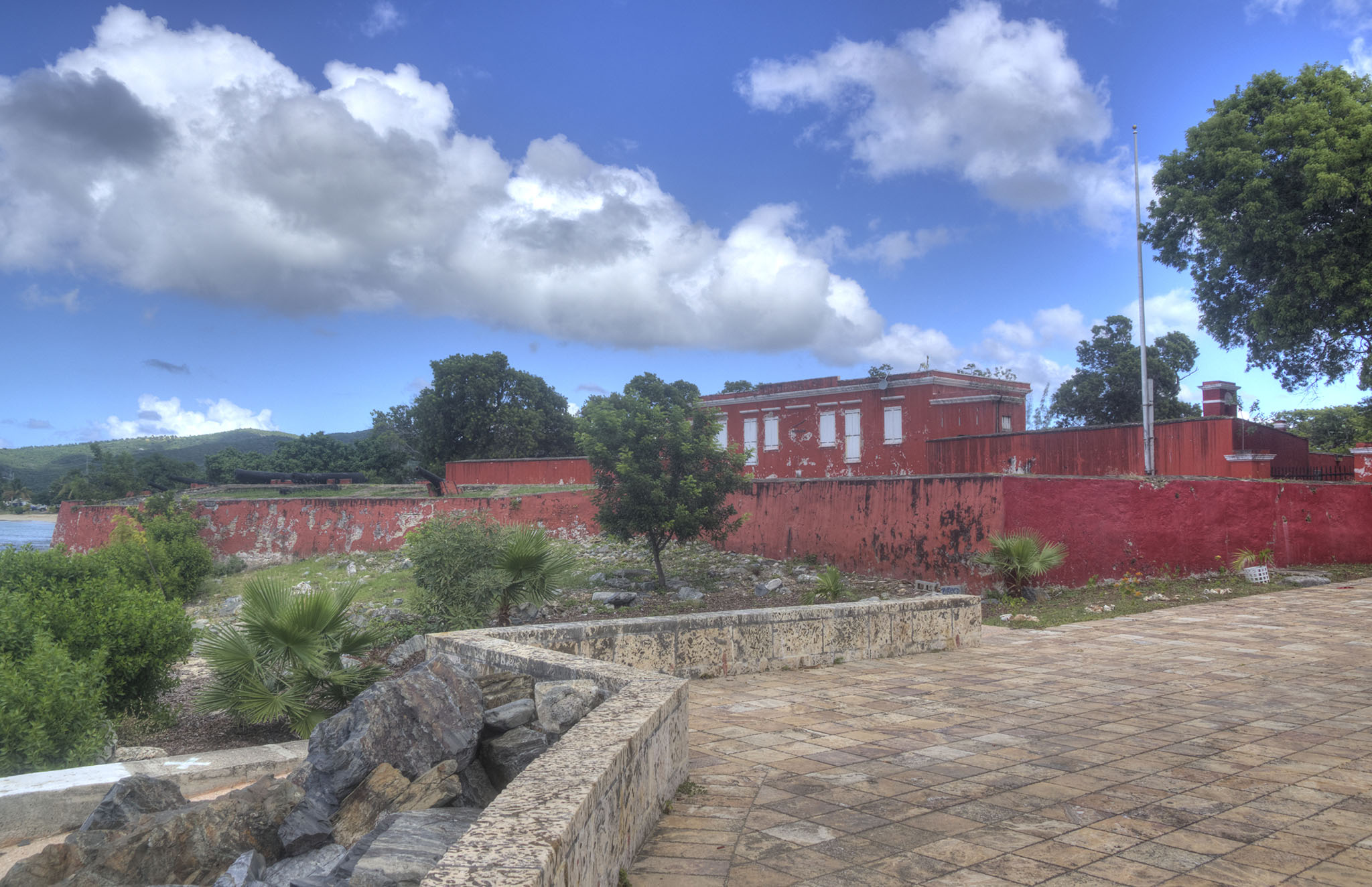
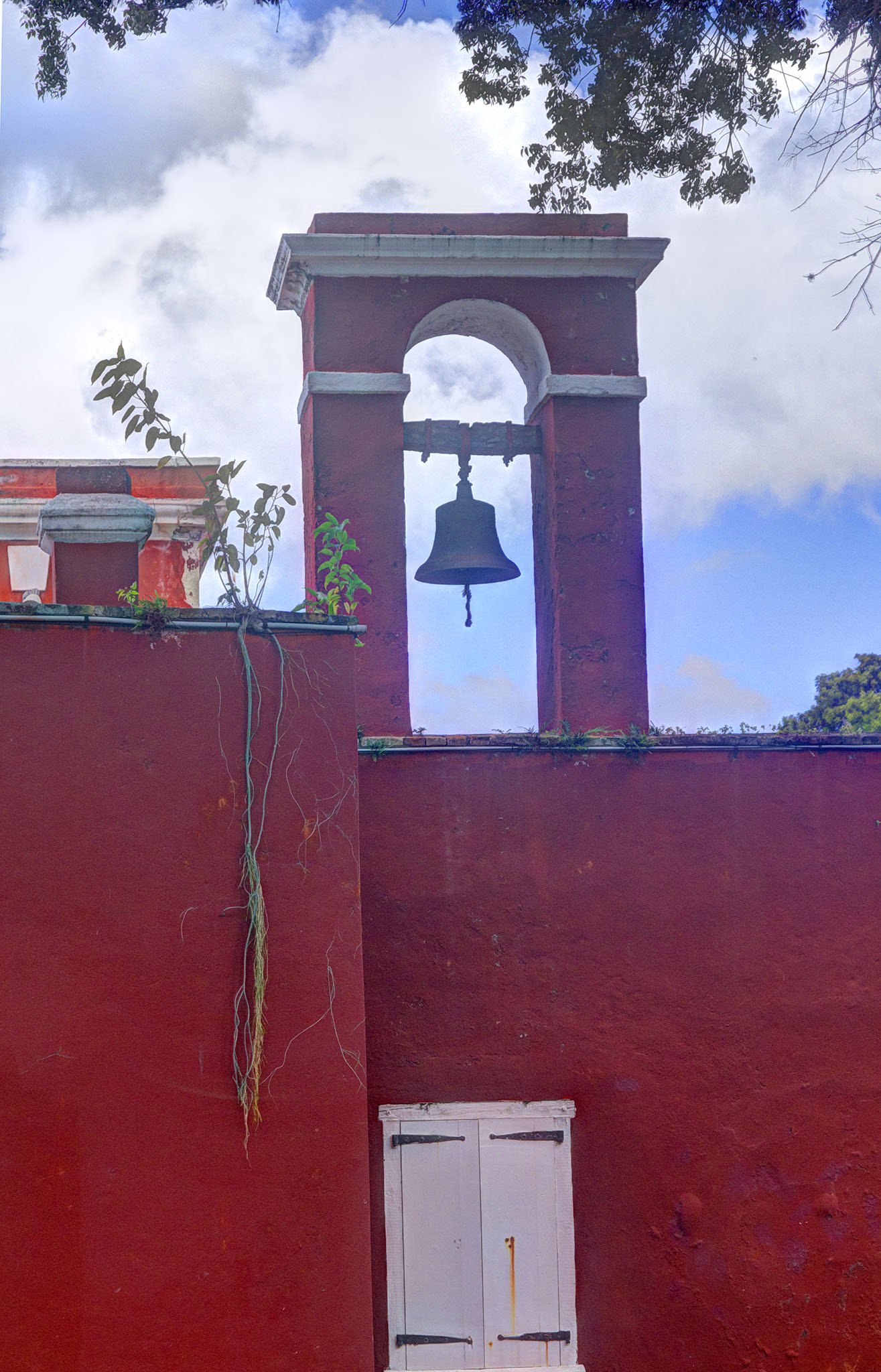
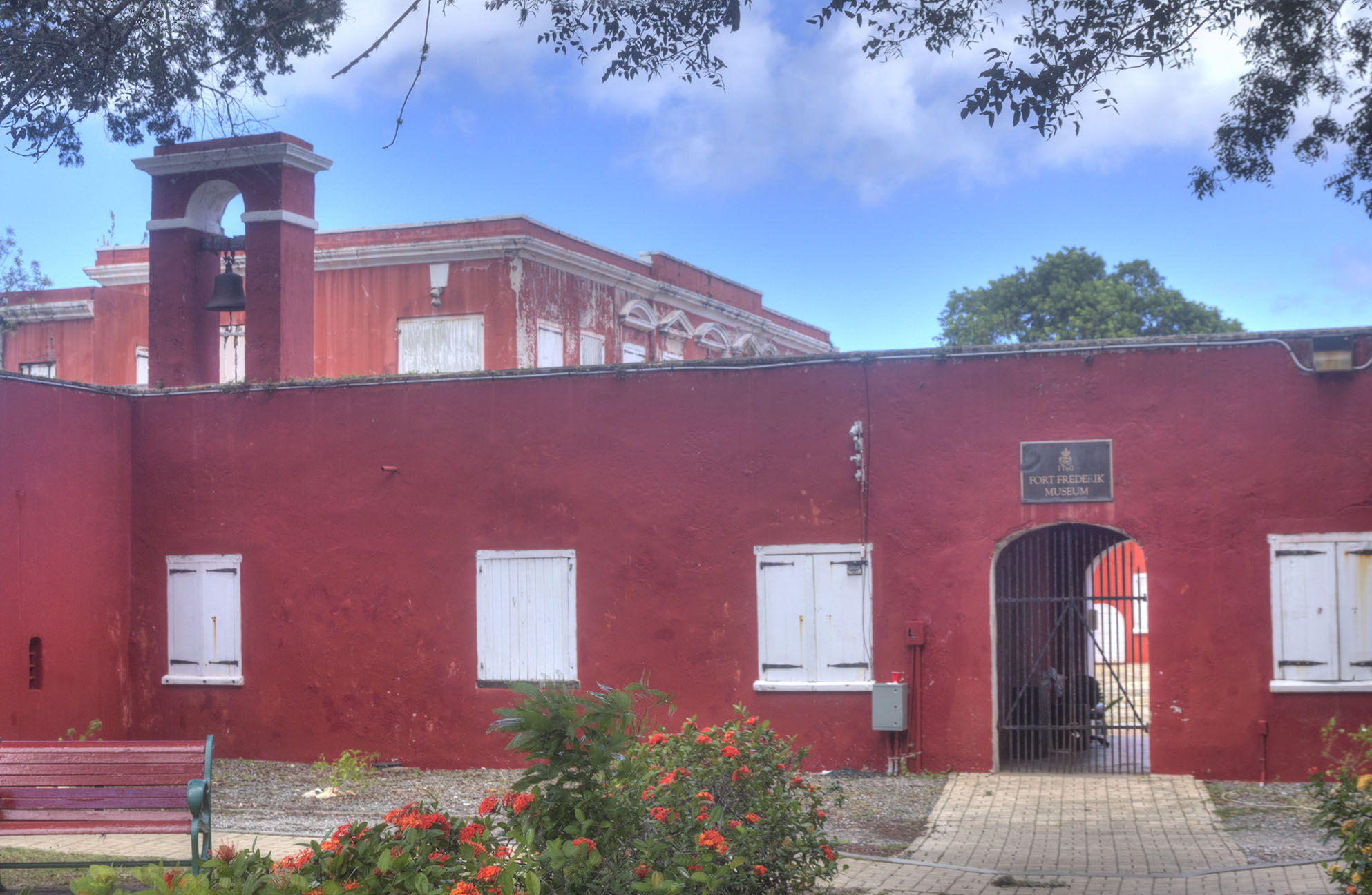
Fort Frederik – Frederiksted
Fort Frederik, also known as Fort Frederiksted or Frederiksfort, is located at the north end of Frederiksted. It was built by the Danish government between 1752 and 1760 to protect St. Croix against invasion, smugglers, and pirates. It is where governor Peter von Scholten, in 1848, declared emancipation of the island’s enslaved laborers to avoid a rebellion. The bright-red historic fort houses a local history museum, courtyard, and stables, and holds historical importance for the island. If you visit, you can learn more about the event of emancipation and explore the exhibits inside the fort. At the time of this writing, the fort is in desperate need of a facelift.
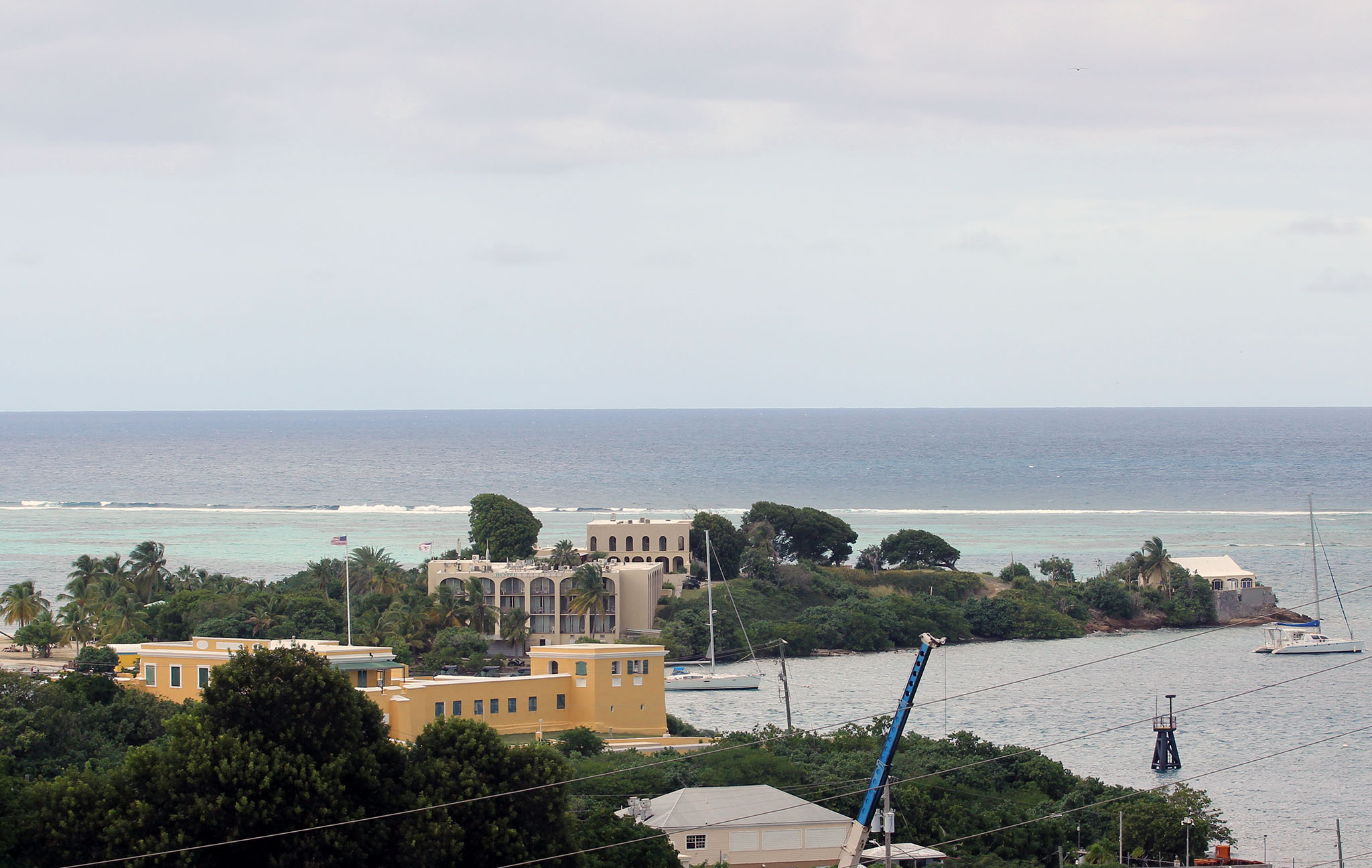
Relative Placement of Christiansted Fort Battlements
A Google Earth view of Christiansted Harbor shows the locations of the three cannon batteries that protected the harbor entrance.
To appreciate the fairly comprehensive defensive coverage of Christiansted Harbor, it’s important to consider that the effective range of cannons during that era was approximately 1,000 yards. The distance from Fort Christiansvaern to Fort Sophia Frederika is 450 yards; from Fort Christiansvaern to Fort Louise Augusta is 1,250 yards; and from Fort Sophia Frederika to Fort Louise Augusta is 1,000 yards.
