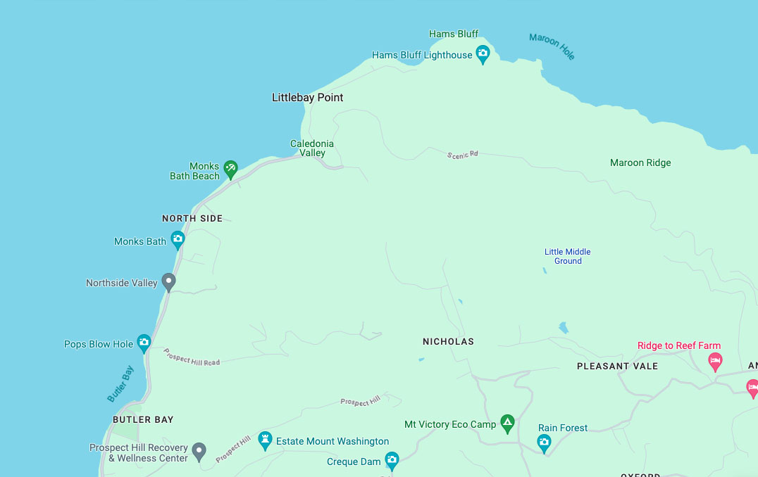
Hams Bluff Lighthouse
Location: 17°46’9.23″N 64°52’15.16″W
National Register of Historic Places: Ref # 100004382
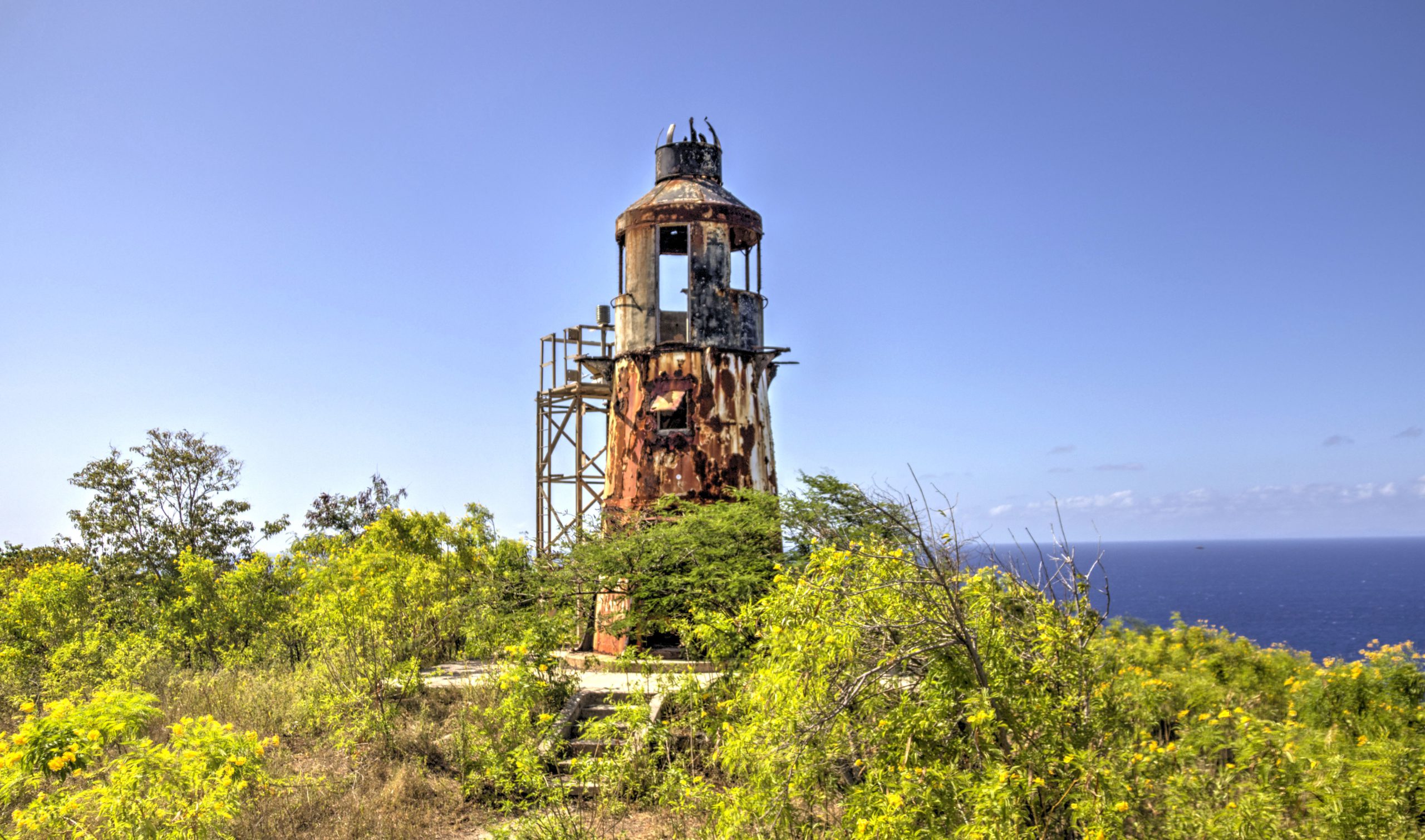

The Hams Bluff Lighthouse, or Light Station complex, was constructed between 1913 and 1915 by the Danish government. It is located on the northwestern coast at the western end of Maroon Ridge, standing approximately 340 feet above sea level, providing a sight distance of about 25 miles. The lighthouse sits at the center of a 0.25-acre circular parcel of land measuring 120 feet in diameter. Initially, the site encompassed 22.5 acres and included the lighthouse, along with two one-story buildings – one serving as the keeper’s quarters and the other as the assistant keeper’s quarters.
In 1912, the Directorate of the Danish Lighthouse Service acquired the property from J. W. Blackwood. Subsequently, Denmark ceded the land to the United States under the Convention of Cession to the United States of the Danish West Indies on August 4, 1916, which was proclaimed by the President of the United States on January 25, 1917, and ratified on March 31 that same year (Transfer Day).
On July 20, 1917, through Executive Order No. 2670, all public property of the former government of the Virgin Islands that was ceded to the United States, including lighthouses and associated public land, was designated for the use of the United States.
Later, on October 21, 1981, the Coast Guard transferred the property to the U.S. Navy, except for the lighthouse and its surrounding 0.25 acres of land.
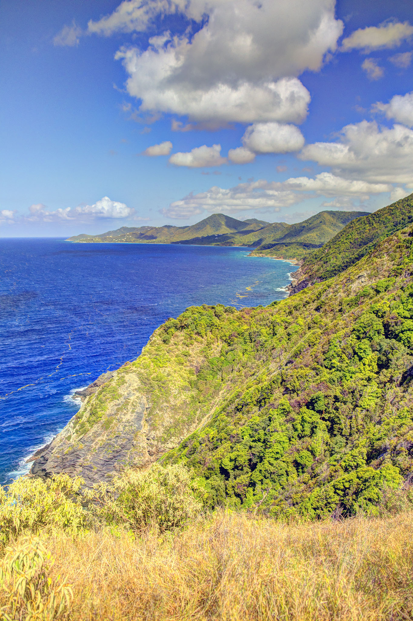
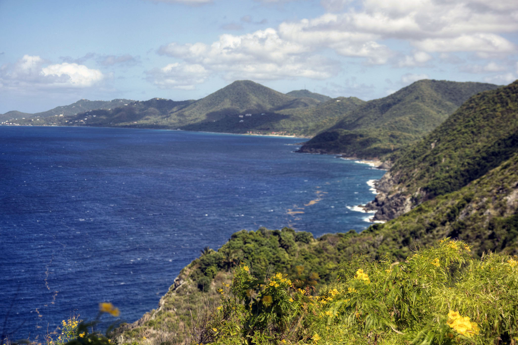
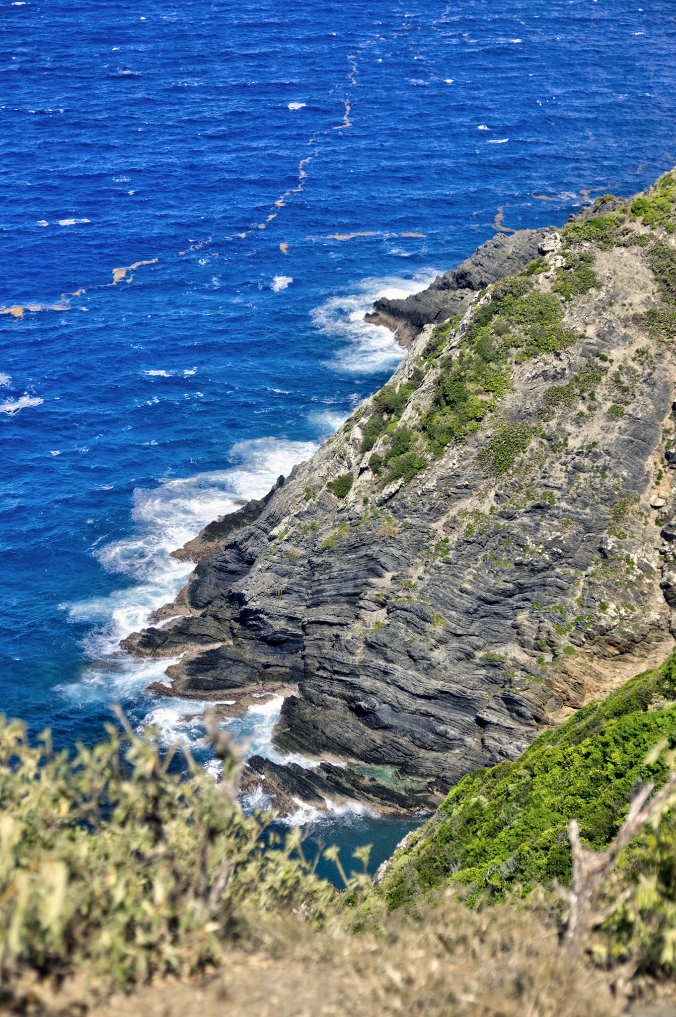
The views from this vantage point are breathtaking, and the layering of the Caledonia formation and uplift is clearly visible.
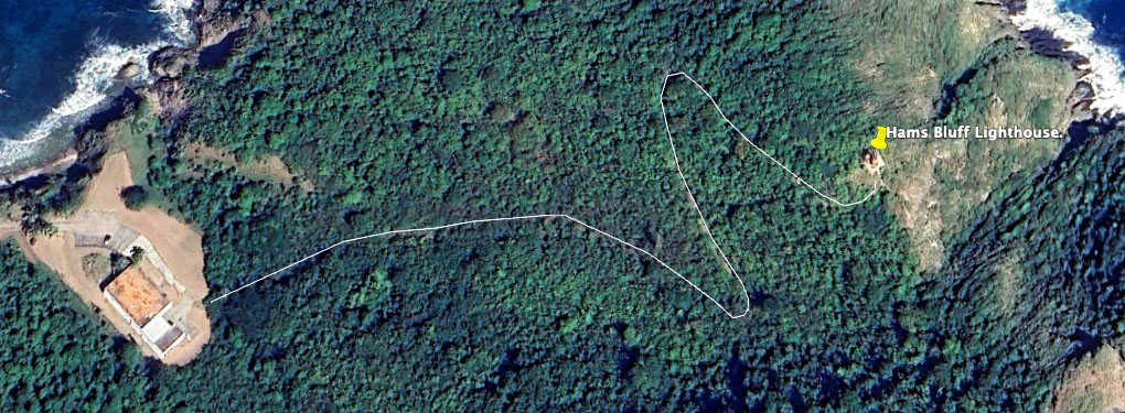
The trailhead is situated approximately 80 feet above sea level. From the parking area, walk up past the left side of the building where you will see a decorated power pole to your left at the entrance to the trail. The trail initially extends almost straight for about 200 yards, ascending around 110 feet. It then veers slightly to the right, continuing for approximately 110 yards until reaching the first left hairpin turn, gaining an additional 40 feet in elevation. The subsequent section spans 150 yards, with a gain of 60 feet in elevation, leading to a right-hand bend where the trail ascends 70 feet over the next 120 yards to the final incline. Finally, the trail curves slightly to the left for about 40 yards, becoming almost level, reaching the plateau of the lighthouse. An average stair height is 7″ so the total of 260 feet of elevation is equivalent to 445 stair steps. The trail acts as a gut following a rain, so it is furrowed with a loose surface, so wear good walking or hiking shoes, and be sure to take plenty of water.
The Library of Congress has resource information, including images of the lighthouse keepers quarters, and the assistant lightkeepers quarters.
The Source published an op-ed by Olasee Davis about the lighthouse and Maroon Ridge.
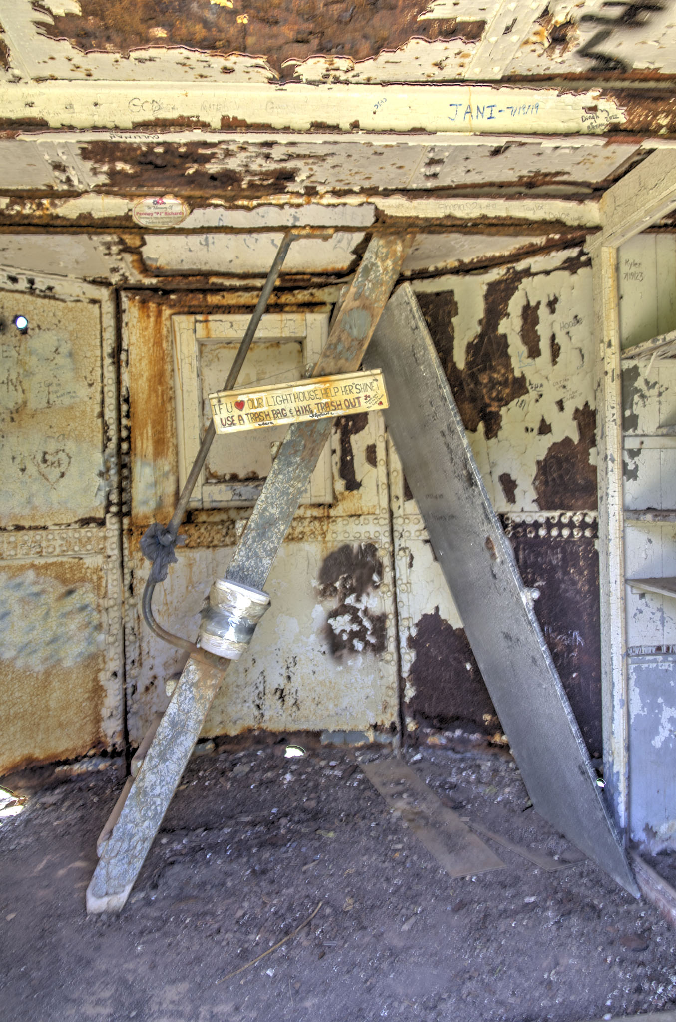
Worth watching is this 2019 Chris Hanley YouTube video “The Last Keeper” where he interviews the last lightkeeper at the lighthouse.
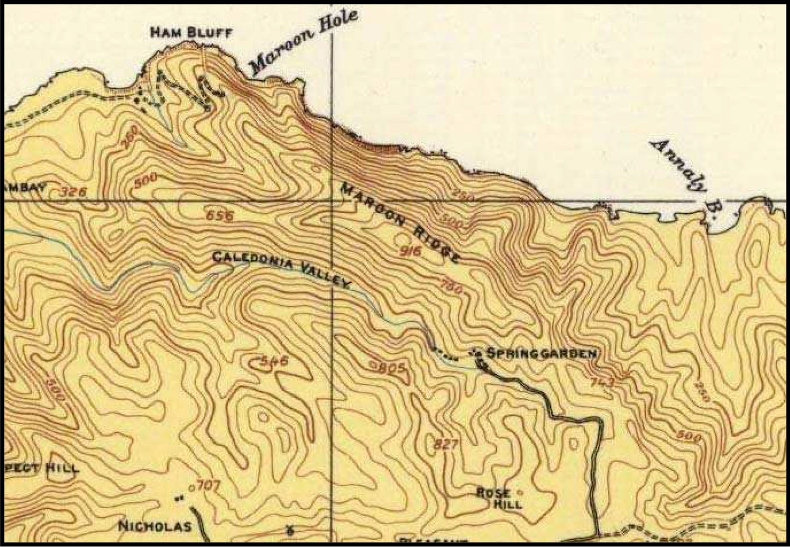
Maroon Ridge is a long ridge in the Caledonian formation as shown in the topo map here, running from Hams Bluff, southeast past Spring Garden. On the Beck map of 1754, the region is noted as “U-optagne Grunde” (undocumented ground).
Historical Information:
Station Established: 1915
Year Current Tower First Lit: 1915
Operational? No
Automated: Yes; 7 February 1975
Deactivated: mid-1990s
Foundation Materials: Concrete
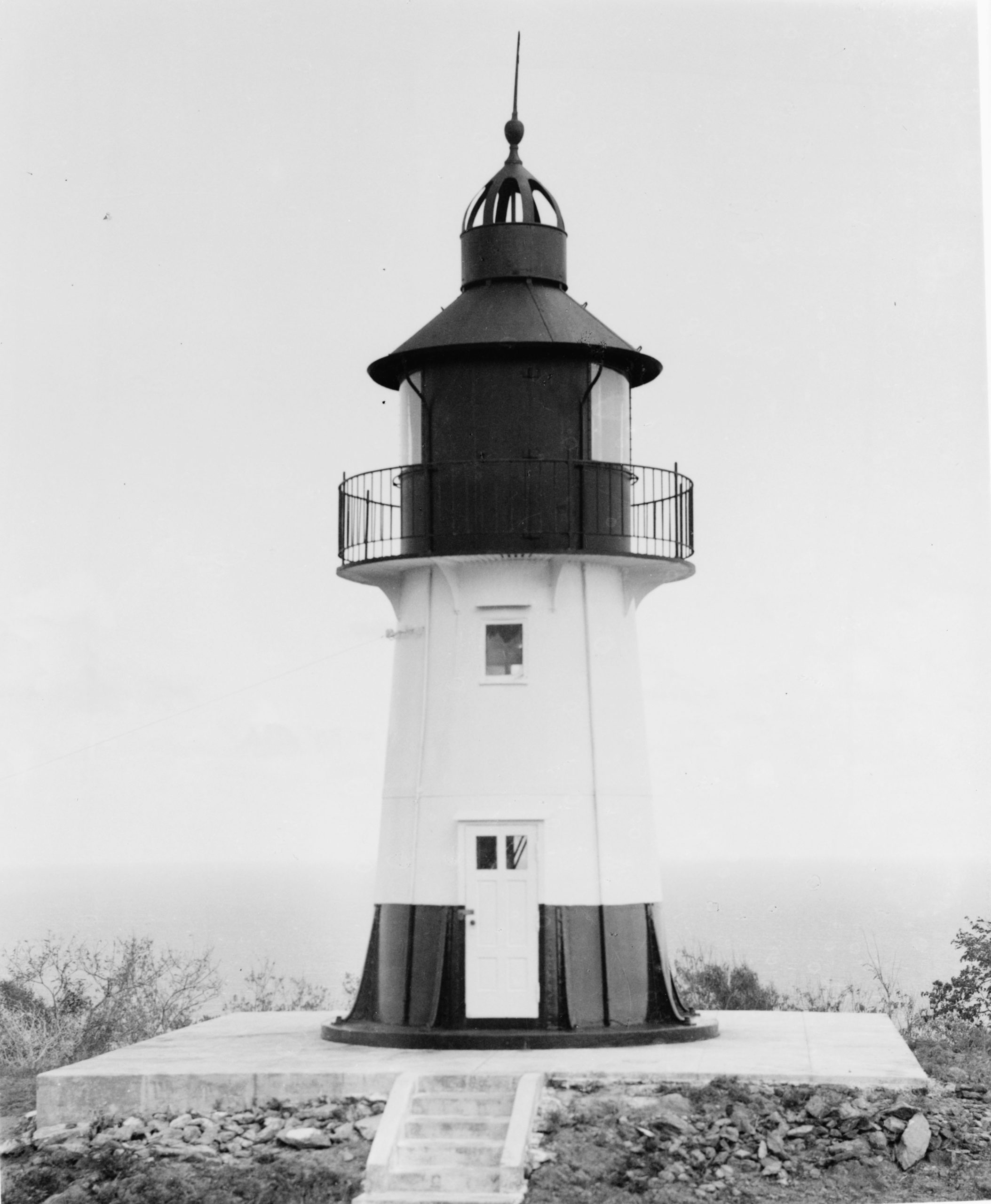
Construction Materials: Cast iron
Tower Shape: Cylindrical
Markings/Pattern: White tower with black cupola
Relationship to Other Structure: Separate; quarters at bottom of hill
Original Lens: Original lens made by A. B. Lux, Company of Denmark; replaced in 1921 with a French-made lens (Barbier, Bernard & Turenne, lens originially constructed 1912-1913). That lens was replaced in 1949 by a lens made in 1949 by “Crouse Hinds, L. H. Beacon, U.S.S.” Quartz-iodine incandescent lamps were added on 15 June 1967