Protestant Cay
Location: 17°44’58.71″N 64°42’10.02″W
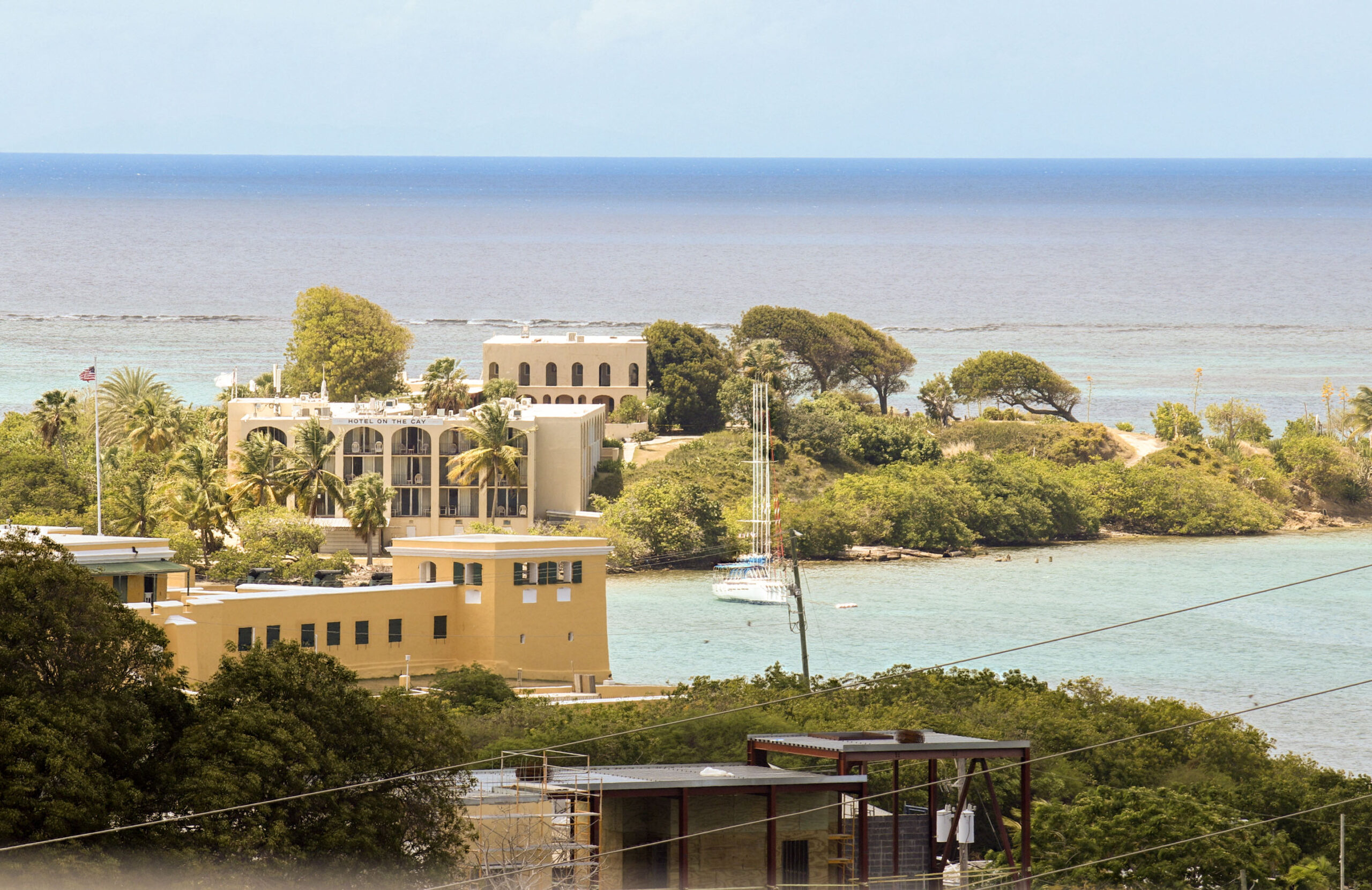
Protestant Cay, previously known as Fort Sophia Frederika and later as Loot’s Kay (Dutch Creole for “pilot’s cay”), is a small four-acre island located about 150 yards northeast of the Christiansted boardwalk. In “St. Croix Under Seven Flags,” Florence Lewisohn states that in 1778, a fort named Fort Sophia Frederica was built on the cay and completed the following year. The fort was named after Sophie Frederikke, daughter of Ludvig, Duke of Mecklenburg-Schwerin. She was married to the brother of King Christian and later became the mother of King Frederik VI. The fort had a battery of four cannons, matching those of Fort Louise Augusta on the opposite point, at the east end of what is now St. Croix Marina, providing crossfire protection for the entrance of Christiansted Harbor. Some reports suggest the fort was constructed in the 1780s and completed in 1788.
Anecdotally, locals believe the island was named for its use as a cemetery for Protestants in the mid-1600s. During this period, the French Catholic Church, which controlled St. Croix from 1650 to 1696, allowed only Catholics to be buried on the mainland, with all non-Catholics buried away from the mainland on what became known as “Protestant Cay.”
An article published in The Daily News in 2016 provides a rich history of the Pilots of the Cay, and The Source published a comprehensive article on Fort Louise Augusta in 2021, including references to Protestant Cay and the burial of Protestant Huguenots.
Protestant Cay is now home to the resort “Hotel on the Cay.” The beach is a favorite among both visitors and residents. It can be reached by a ferry that runs every ten minutes from 7 a.m. to 12 a.m., at a cost of $5.00 per person for a round trip, payable upon arrival at the cay. The ferry is free for hotel guests and for all others after 4 p.m. on weekdays and 5 p.m. on weekends. To catch the ferry, wait at the corner of the boardwalk across from the cay dock.