“A popular misconception in tourist lore is that St Croix was formerly a volcano.”
That’s the opening line of FIELD GUIDE TO THE GEOLOGY OF ST. CROIX, U.S. VIRGIN ISLANDS, written in 1966 by John T. Whetten, and presented to the 5th Caribbean Geological Conference in 1968. I came across his paper while researching the Kingshill Marl for the Lime page.
In 1912, meteorologist Alfred Wegener introduced the term “continental drift” and further elaborated on the theory in his 1915 book, “The Origin of Continents and Oceans.” Whetten’s paper was written during the period when Wegener’s concepts of continental drift were being embraced, leading to the development of our current understanding of Plate Tectonics.
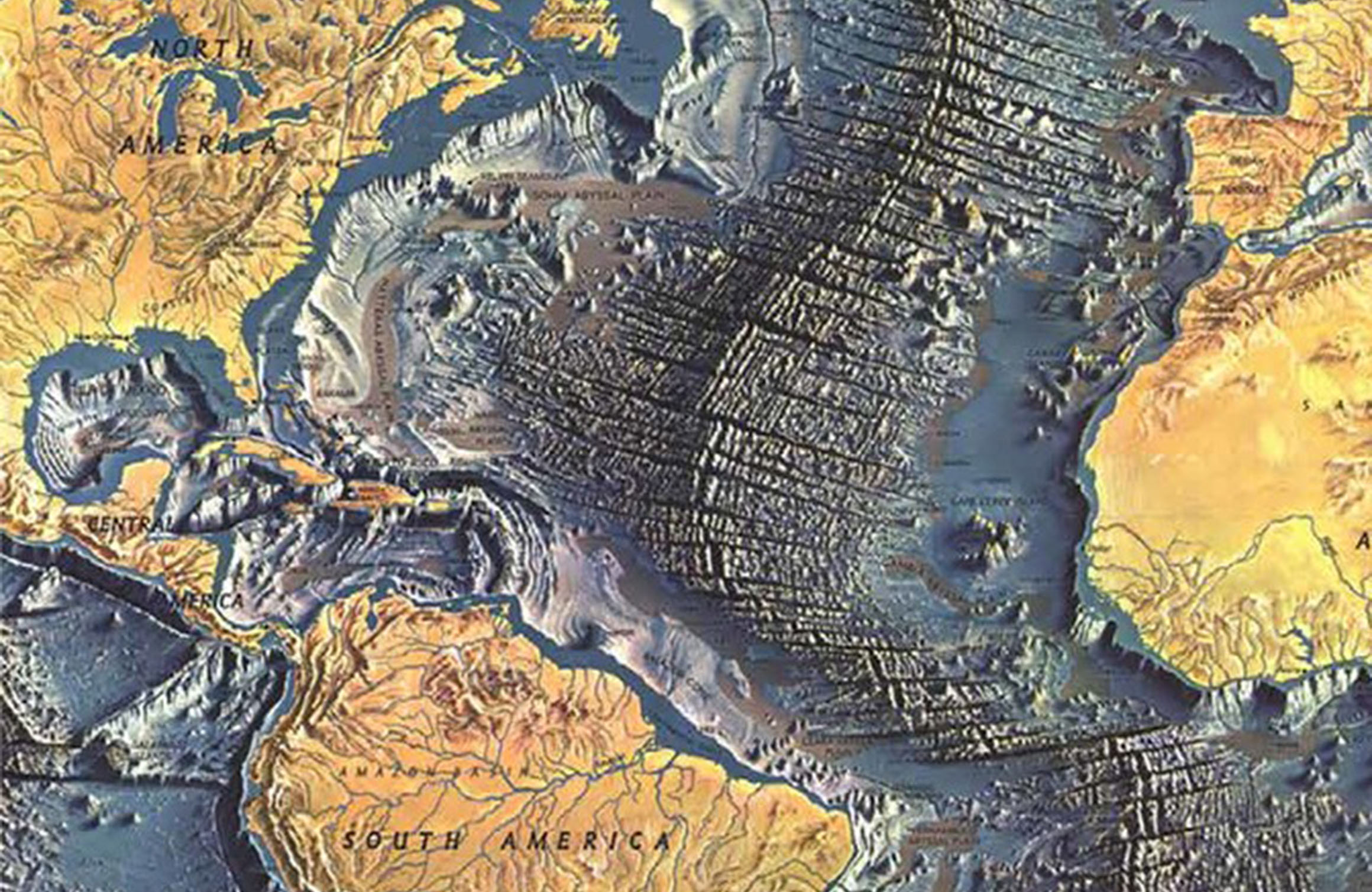
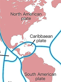
St. Croix is situated on the Caribbean Plate, which forms part of the extensive boundary between the North American Plate and the South American Plate. The characteristics of the Caribbean Plate are intricate, with the Puerto Rico Trench located to the north – this trench is the deepest in the Atlantic, reaching a maximum depth of 8,376 meters or 27,480 feet, nearly equivalent to the height of Mt. Everest.

The Caribbean Plate is shifting eastward in relation to the North American Plate. At the Puerto Rico Trench, a transform boundary exists with a minor subduction component. Further southeast, the South American Plate undergoes more direct subduction along the Lesser Antilles subduction zone. This subduction zone accounts for the presence of 21 active volcanoes in the southeastern Caribbean Sea. These include “La Soufrière” on St. Vincent, the “Jimmy Buffett” volcano, and “Soufriere Hills” on Montserrat. The volcanic range extends from “Mount Liamuiga” on St. Kitts in the north to the underwater volcano “Kick ’em Jenny” near Grenada in the south.
While our foundation originates from undersea volcanic activity millions of years in the past, our region is devoid of active volcanoes, attributed to a transform boundary and the presence of the Puerto Rico trench.
